


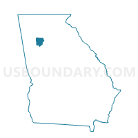
067DI01 - DOBBINS 01 Voting District, Cobb County, Georgia
About
Outline

Summary
| Unique Area Identifier | 560799 |
| Name | 067DI01 - DOBBINS 01 Voting District |
| County | Cobb County |
| State | Georgia |
| Area (square miles) | 6.19 |
| Land Area (square miles) | 6.16 |
| Water Area (square miles) | 0.04 |
| % of Land Area | 99.41 |
| % of Water Area | 0.59 |
| Latitude of the Internal Point | 33.91259570 |
| Longtitude of the Internal Point | -84.51328210 |
Maps


Graphs
Select a template below for downloading or customizing gragh for 067DI01 - DOBBINS 01 Voting District, Cobb County, Georgia


Neighbors
Neighoring Voting District (by Name) Neighboring Voting District on the Map
- 067BY01 - BRUMBY 01 Voting District, Cobb County, GA
- 067CA01 - CHATTAHOOCHEE 01 Voting District, Cobb County, GA
- 067FO05 - FAIR OAKS 05 Voting District, Cobb County, GA
- 067FO06 - FAIR OAKS 06 Voting District, Cobb County, GA
- 067MR1A - MARIETTA 1A Voting District, Cobb County, GA
- 067MR3A - MARIETTA 3A Voting District, Cobb County, GA
- 067MR7A - MARIETTA 7A Voting District, Cobb County, GA
- 067SN1A - SMYRNA 1A Voting District, Cobb County, GA
- 067SN2A - SMYRNA 2A Voting District, Cobb County, GA
- 067SN2B - SMYRNA 2B Voting District, Cobb County, GA
- 067SN3A - SMYRNA 3A Voting District, Cobb County, GA
- 067SN5A - SMYRNA 5A Voting District, Cobb County, GA
- 067TS01 - TEASLEY 01 Voting District, Cobb County, GA
- 067VG01 - VININGS 01 Voting District, Cobb County, GA
Top 10 Neighboring County Subdivision (by Population) Neighboring County Subdivision on the Map
- Northeast Cobb CCD, Cobb County, GA (152,795)
- Marietta CCD, Cobb County, GA (116,739)
- Smyrna CCD, Cobb County, GA (56,941)
- Vinings CCD, Cobb County, GA (32,670)
- Fair Oaks CCD, Cobb County, GA (25,580)
Top 10 Neighboring Place (by Population) Neighboring Place on the Map
- Marietta city, GA (56,579)
- Smyrna city, GA (51,271)
- Vinings CDP, GA (9,734)
- Fair Oaks CDP, GA (8,225)
Top 10 Neighboring Unified School District (by Population) Neighboring Unified School District on the Map
Top 10 Neighboring State Legislative District Lower Chamber (by Population) Neighboring State Legislative District Lower Chamber on the Map
- State House District 34, GA (53,448)
- State House District 41, GA (46,462)
- State House District 38, GA (46,017)
- State House District 44, GA (45,368)
- State House District 40, GA (43,063)
Top 10 Neighboring State Legislative District Upper Chamber (by Population) Neighboring State Legislative District Upper Chamber on the Map
Top 10 Neighboring 111th Congressional District (by Population) Neighboring 111th Congressional District on the Map
- Congressional District 11, GA (794,969)
- Congressional District 13, GA (784,445)
- Congressional District 6, GA (767,798)
Top 10 Neighboring Census Tract (by Population) Neighboring Census Tract on the Map
- Census Tract 311.14, Cobb County, GA (6,722)
- Census Tract 309.02, Cobb County, GA (5,843)
- Census Tract 312.08, Cobb County, GA (5,679)
- Census Tract 304.13, Cobb County, GA (5,271)
- Census Tract 303.39, Cobb County, GA (5,268)
- Census Tract 310.01, Cobb County, GA (5,215)
- Census Tract 311.08, Cobb County, GA (4,910)
- Census Tract 303.45, Cobb County, GA (4,623)
- Census Tract 308, Cobb County, GA (4,052)
- Census Tract 304.12, Cobb County, GA (3,776)